Sentinel Landscape Nicaragua-Honduras advances to 2014
22
Sentinel Landscape Nicaragua- Honduras advances to 2014 Jenny Ordonez Norvin Sepulveda Sentinel Landscapes workshop Costa Rica 3-7 March 2014 4/17/2014
-
Upload
forest-trees-sentinel-landscapes -
Category
Science
-
view
177 -
download
0
Transcript of Sentinel Landscape Nicaragua-Honduras advances to 2014

Sentinel Landscape Nicaragua-Honduras advances to 2014
Jenny Ordonez Norvin Sepulveda
Sentinel Landscapes workshop Costa Rica 3-7 March 2014 4/17/2014

The Nicaragua Honduras SL 68 000 km2 which includes 2 biosphere reserves and 13 protected areas in Nicaragua and Honduras
Map by Norvin Sepulveda and Noel Ulloa 4/17/2014
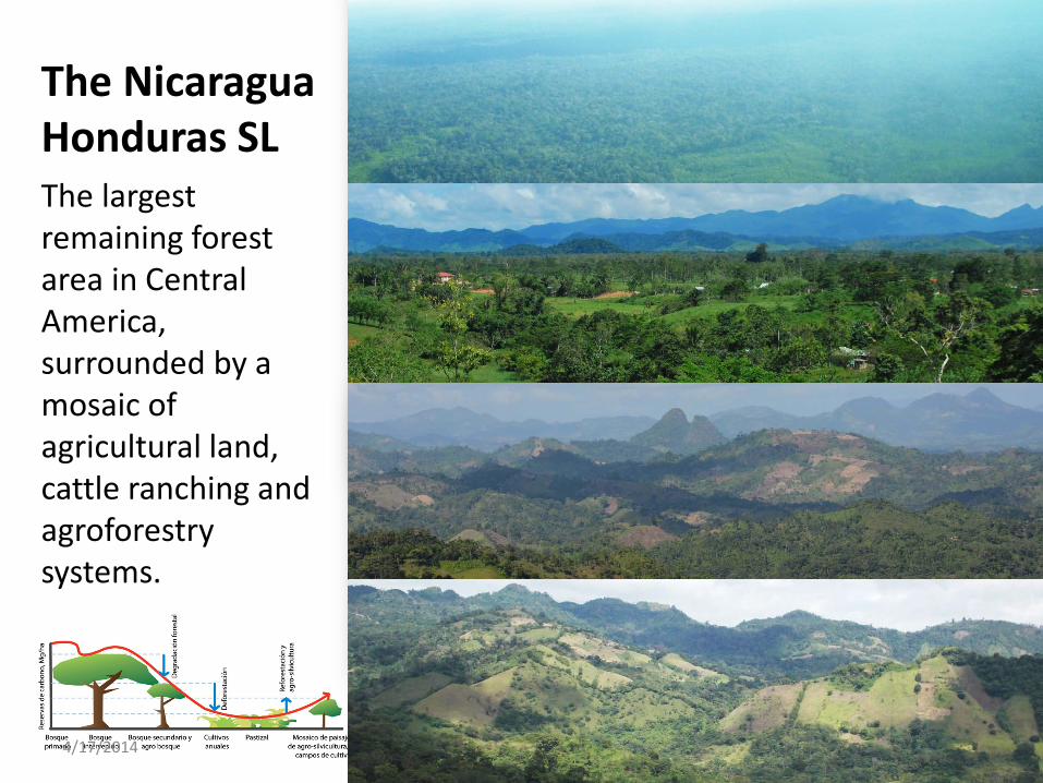
The Nicaragua Honduras SL The largest remaining forest area in Central America, surrounded by a mosaic of agricultural land, cattle ranching and agroforestry systems.
4/17/2014

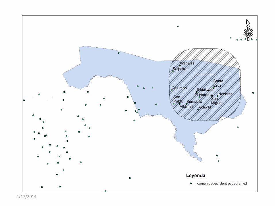
Ni-Ho-SL: Site selection • 13 candidate sites
• 4 sites chosen in discussion
with local partners: – Cover the forest transition
curve
– Representative of main land use and forest types in the landscape
– Presence of partners in the site
– Security and accessibility 4/17/2014
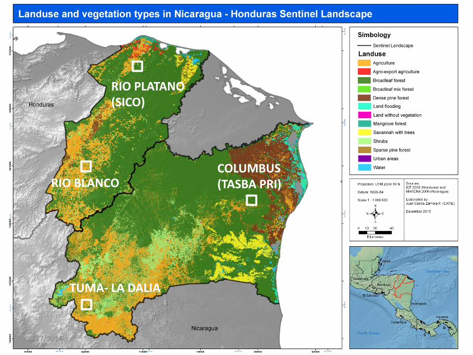
RIO PLATANO (SICO)
RIO BLANCO COLUMBUS (TASBA PRI)
TUMA- LA DALIA
4/17/2014

RIO PLATANO (SICO)
RIO BLANCO COLUMBUS (TASBA PRI)
TUMA- LA DALIA
4/17/2014
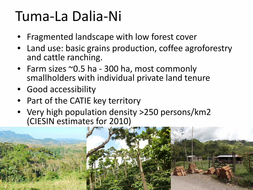
Tuma-La Dalia-Ni • Fragmented landscape with low forest cover • Land use: basic grains production, coffee agroforestry
and cattle ranching. • Farm sizes ~0.5 ha - 300 ha, most commonly
smallholders with individual private land tenure • Good accessibility • Part of the CATIE key territory • Very high population density >250 persons/km2
(CIESIN estimates for 2010)
4/17/2014
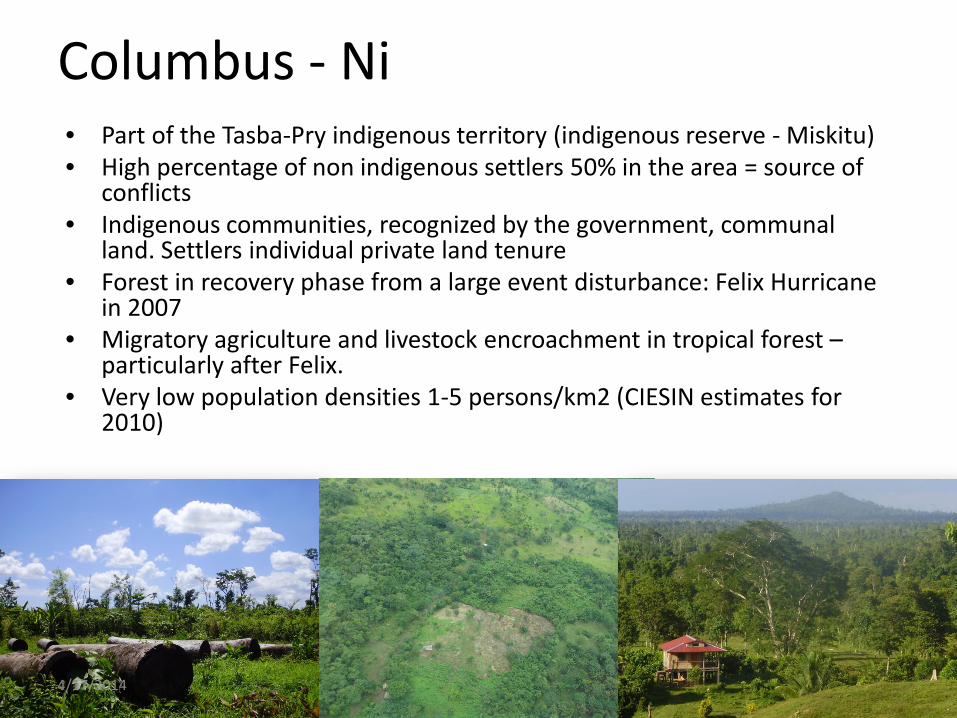
Columbus - Ni • Part of the Tasba-Pry indigenous territory (indigenous reserve - Miskitu) • High percentage of non indigenous settlers 50% in the area = source of
conflicts • Indigenous communities, recognized by the government, communal
land. Settlers individual private land tenure • Forest in recovery phase from a large event disturbance: Felix Hurricane
in 2007 • Migratory agriculture and livestock encroachment in tropical forest –
particularly after Felix. • Very low population densities 1-5 persons/km2 (CIESIN estimates for
2010)
4/17/2014
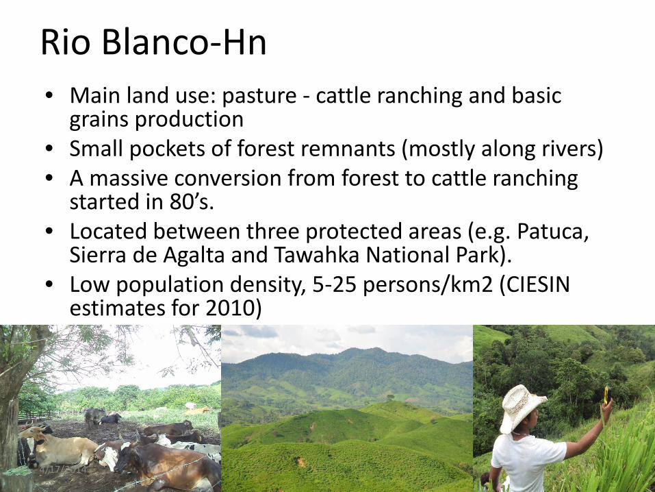
Rio Blanco-Hn • Main land use: pasture - cattle ranching and basic
grains production • Small pockets of forest remnants (mostly along rivers) • A massive conversion from forest to cattle ranching
started in 80’s. • Located between three protected areas (e.g. Patuca,
Sierra de Agalta and Tawahka National Park). • Low population density, 5-25 persons/km2 (CIESIN
estimates for 2010)
4/17/2014
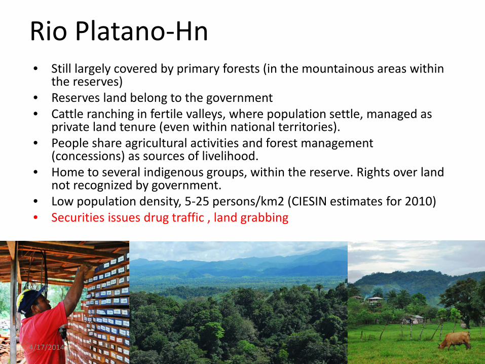
Rio Platano-Hn • Still largely covered by primary forests (in the mountainous areas within
the reserves) • Reserves land belong to the government • Cattle ranching in fertile valleys, where population settle, managed as
private land tenure (even within national territories). • People share agricultural activities and forest management
(concessions) as sources of livelihood. • Home to several indigenous groups, within the reserve. Rights over land
not recognized by government. • Low population density, 5-25 persons/km2 (CIESIN estimates for 2010) • Securities issues drug traffic , land grabbing
4/17/2014
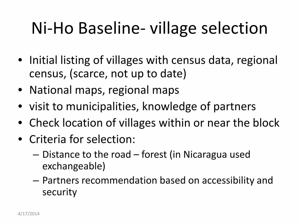
Ni-Ho Baseline- village selection
• Initial listing of villages with census data, regional census, (scarce, not up to date)
• National maps, regional maps • visit to municipalities, knowledge of partners • Check location of villages within or near the block • Criteria for selection:
– Distance to the road – forest (in Nicaragua used exchangeable)
– Partners recommendation based on accessibility and security
4/17/2014
4/17/2014

La Dalia
4/17/2014
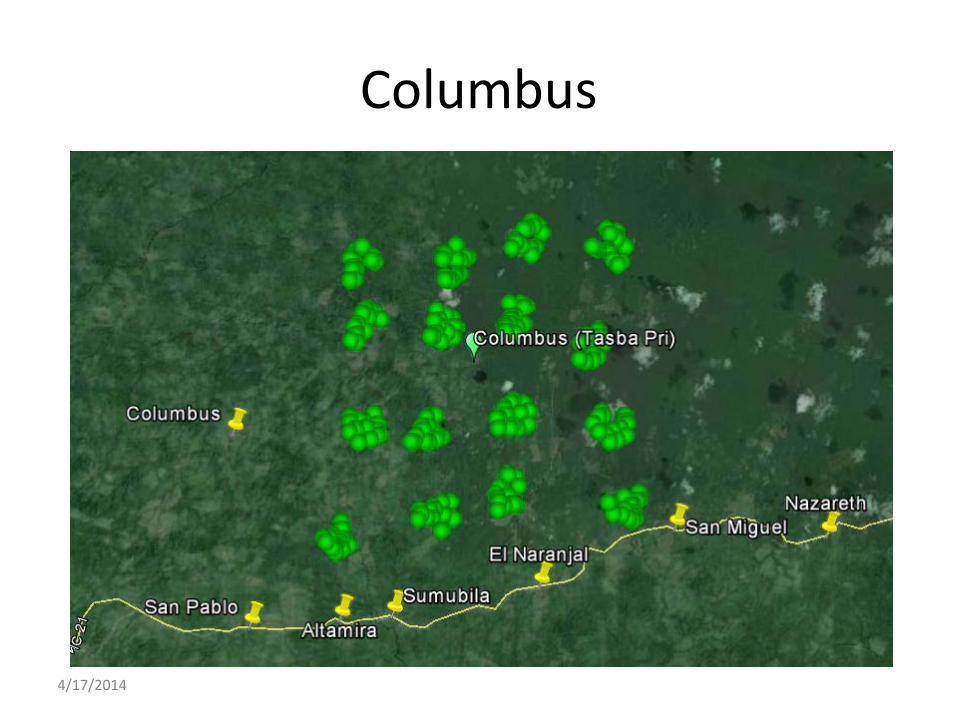
Columbus
4/17/2014
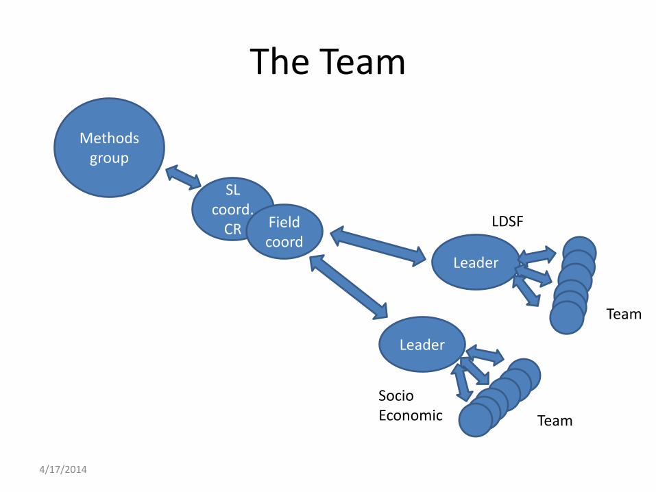
The Team
Methods group
SL coord.
CR Field coord
Leader
Leader
LDSF
Socio Economic
Team
Team
4/17/2014

The Team
Methods group
SL coord.
CR Field coord
1
1-2
X 2
X 4
7-8
4-7
4/17/2014

Socio – economic survey
• Tuma: – 8 communities – 297 HH, 158 forms (IFRI and
ISOP)
• Columbus – 8 communities – 121 HH, 136 forms (IFRI and
ISOP) 3-5 days per village
4/17/2014
Collection of information – village level
• Random selection of HH, based on lists of households from leaders, and snowball.
• IFRI survey: – Mostly workshops ideally at least 30 participants – Focal groups smaller groups (particularly for user and
products) – Key informants leaders, teacher – Individual interviews (users and products) – People chosen in coordination with the leaders of the
villages – As much as possible 50% men and 50% women
4/17/2014
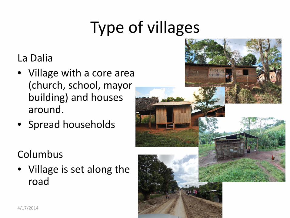
Type of villages
La Dalia • Village with a core area
(church, school, mayor building) and houses around.
• Spread households Columbus • Village is set along the
road
4/17/2014
Gender components
• Try to get more participation of women • Consider not only farming activities but also
household activities to plan interviews • Perhaps other approaches needed to go
beyond conditions (this is a good starting point), but we need to get to power relations.
4/17/2014

Co-location?
4/17/2014
Thanks
4/17/2014