Capitulo III Necesidades Hidricas de Los Cultivos - Modificado
Upload
reina-hodesCategory
view
224download
1

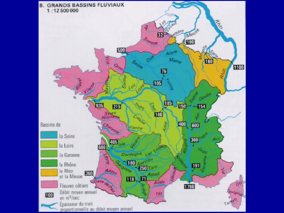
GRANDES VERTIENTES HIDRICAS EUROPEAS

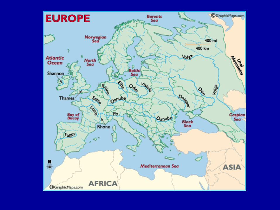

CAUDAL MEDIO ANUAL DE LOS RÍOS EUROPEOS


El Rhin

CANAL RHIN DANUBIO

VOLGA

VOLGA
• The Volga River, the largest and longest river system is Europe rises in the hills just northwest of Moscow, and then flows 2,300 miles (3,700 km) to the east and southeast before emptying into the more than 200 tributaries merge with the main river, including the Kama, Samara and Oka. And in fact, the Volga and its tributaries occupy a watershed covering about 560,000 sq. mi. (1,450,000 sq. km), which is almost 41% of the European landmass.
When a series of canals were finished in the early 19th century - canals that eventually linked the Volga and the Baltic Sea - economic development along the river increased dramatically
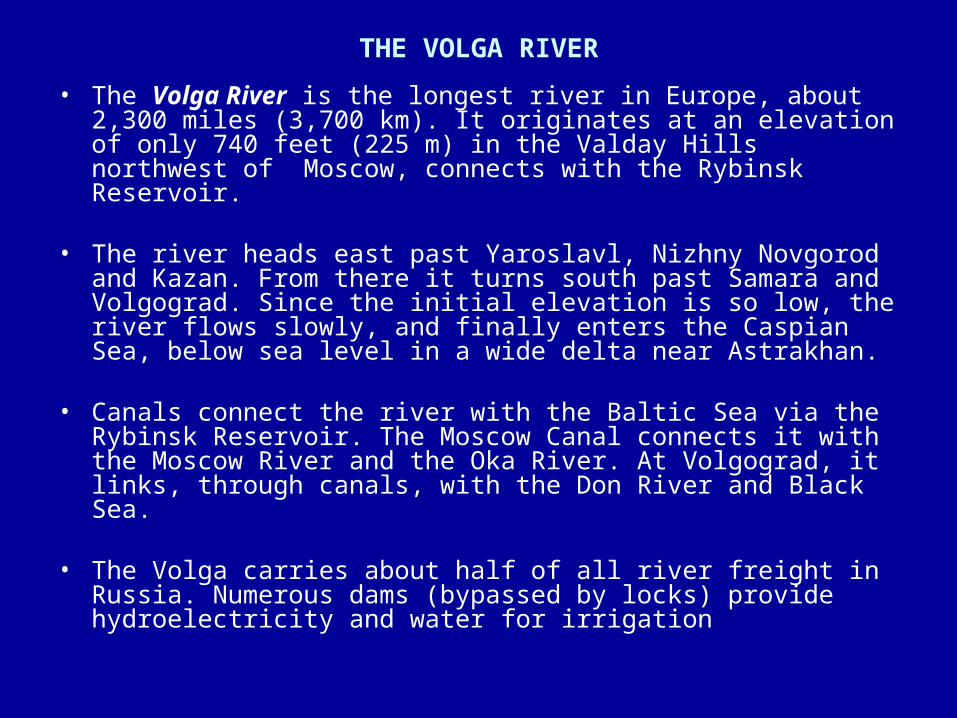
THE VOLGA RIVER
• The Volga River is the longest river in Europe, about 2,300 miles (3,700 km). It originates at an elevation of only 740 feet (225 m) in the Valday Hills northwest of Moscow, connects with the Rybinsk Reservoir.
• The river heads east past Yaroslavl, Nizhny Novgorod and Kazan.
From there it turns south past Samara and Volgograd. Since the initial elevation is so low, the river flows slowly, and finally enters the Caspian Sea, below sea level in a wide delta near Astrakhan.
• Canals connect the river with the Baltic Sea via the Rybinsk
Reservoir. The Moscow Canal connects it with the Moscow River and the Oka River. At Volgograd, it links, through canals, with the Don River and Black Sea.
• The Volga carries about half of all river freight in Russia. Numerous
dams (bypassed by locks) provide hydroelectricity and water for irrigation
VOLGA
• The Volga River, the largest and longest river system is Europe rises in the hills just northwest of Moscow, and then flows 2,300 miles (3,700 km) to the east and southeast before emptying into the Caspian Sea. More than 200 tributaries merge with the main river, including the Kama, Samara and Oka. And in fact, the Volga and its tributaries occupy a watershed covering about 560,000 sq. mi. (1,450,000 sq. km), which is almost 41% of the European landmass. When a series of canals were finished in the early 19th century - canals that eventually linked the Volga and the Baltic Sea - economic development along the river increased dramatically.
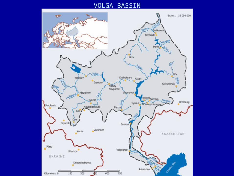
VOLGA BASSIN
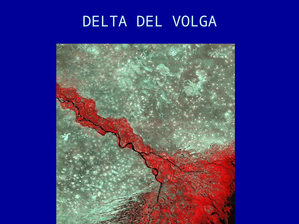
DELTA DEL VOLGA

RIO PO
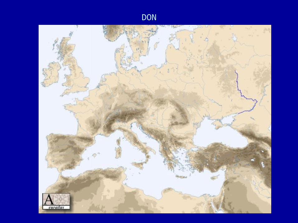
DON

TAMESIS

ELBA
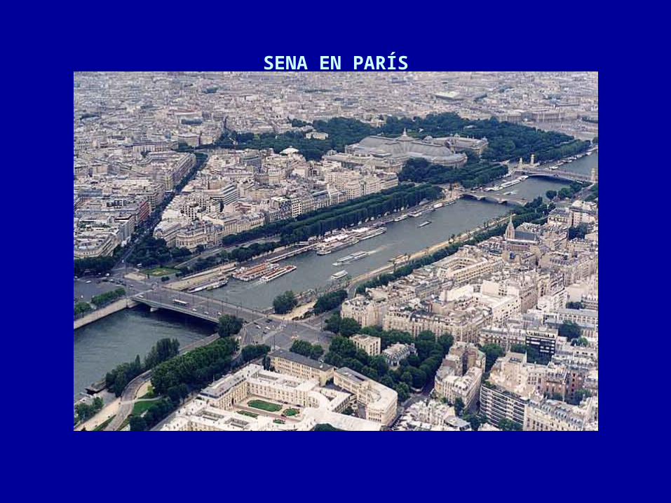
SENA EN PARÍS
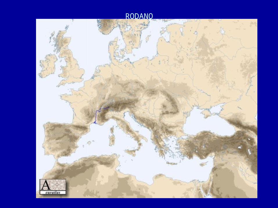
RODANO

PROPOSED WATER PIPE-LINE. RHONE – BARCELONA (1995)

RHONE – BARCELONA PROPOSED AQUEDUCT
The Rhone-Barcelona aqueduct has been promoted since 1995 by the French company BRL which has a French State concession to Rhone river water rights until 2056. It envisages the construction of a ground pipe of 330 kms, intended to transfer 15 m3/sec (1,300,000 m³/day) from Arles to Barcelona.
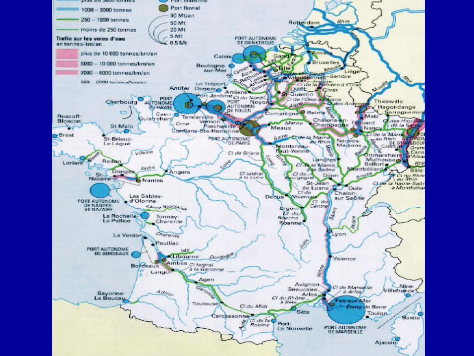
VIAS NAVEGABLES EN FRANCIA

Canales de Francia

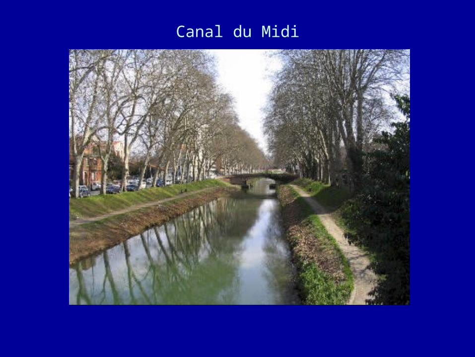
Canal du Midi
• The original purpose of the Canal du Midi was to be a shortcut between the Atlantic and the Mediterranean, avoiding the long sea voyage around hostile Spain, Barbary pirates, and a trip that in the 17th century required a full month of sailing
• The Canal has 103 locks which serve to climb and descend a total of 190 meters. The Canal has 328 structures, including not only the locks but also bridges, dams and a tunnel.
• The Canal connects the Garonne River to the Mediterranean.
• To do so, the Canal is 240 km in length and runs from the city of Toulouse down to the Mediterranean port of Sète (which was founded to serve as the eastern terminus of the Canal.)
• The Canal has 103 locks which serve to climb and descend a total of 190 meters. The Canal has 328 structures, including not only the locks but also bridges, dams and a tunnel.
Canal du Midi

The Canal du Midi basin at the town of Castelnaudary

The Canal du Midi, approaching the round lock at Agde.
Note the tow path along the Canal.

EUROPEAN INLAND WATERWAYS
• Inland waterway transport plays an important role for the transport of goods in Europe. More than 35.000 kilometres of waterways connect hundreds of cities and industrial regions
• While 18 out of 25 Member States have inland waterways, 10 of which have an interconnected waterway network, the modal share of river transport accounts for 7% of the total inland transport in the European Union.
• In 2003, 125 billion ton-kilometres of freight were transported by inland waterways in the Union. Fluvial transport plays a vital role in transport through the European North-west.
• In the hinterland of the largest seaports of the EU, the modal
share of inland waterway transport can reach up to 43%.
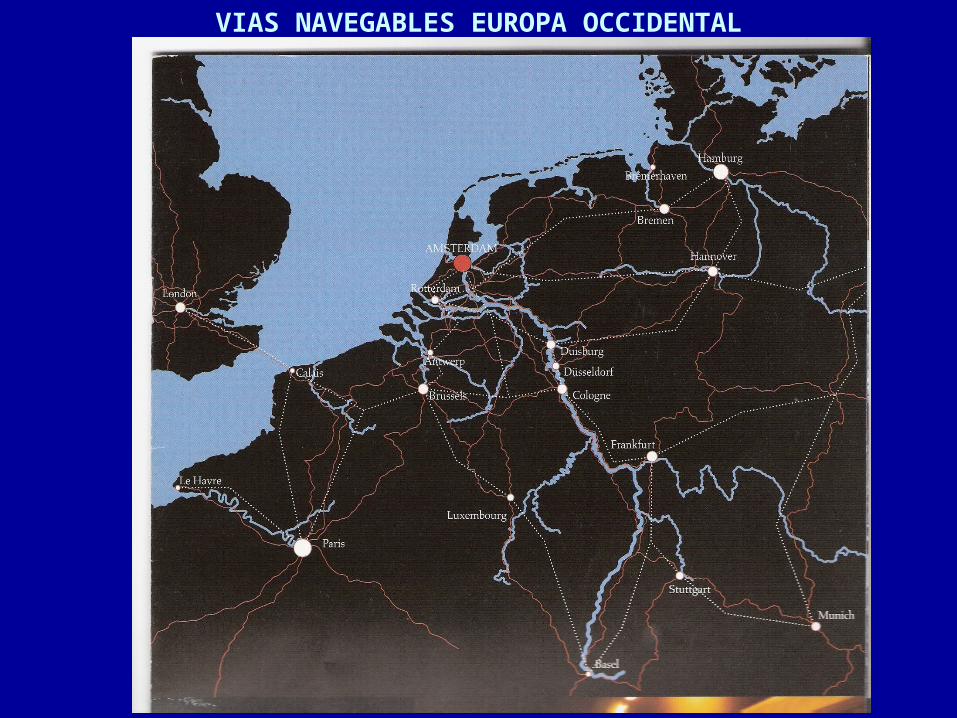
VIAS NAVEGABLES EUROPA OCCIDENTAL
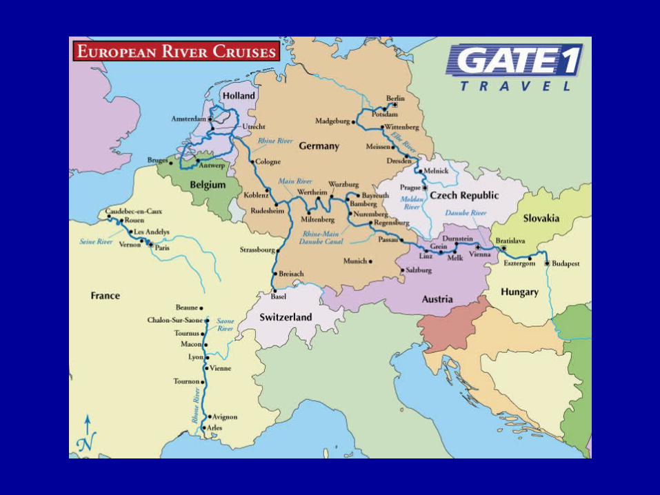

CRUCEROS POR EL RHIN